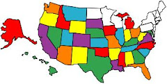
We've had a lot of our friends tell us they'd like to go to Alaska but they can't afford it, the fuel alone would be too expensive for us. We I have to admit that fuel in Canada and Alaska was not as inexpensive as it is in some of the "lower 48" states but when you convert liters to gallons and change Canadian to U.S. Dollars, it's not quite as bad as we thought.
We first rolled out from Tarpley, Texas in mid February and didn't return to the "lower 48" until mid August, that's about six months on the road in a diesel motor home pulling a Honda CRV. The motor home has a 100 gallon tank and we never let it get much below a half of a tank before we fill up again.
A good bit of our trip in the "lower 48" we drove not over 55 miles per hour because a couple traveling with us had a car that could not be towed over 55. Once we got into Canada we lowered our speed to about 45 miles per hour due to the road condition in spots and also so that if we saw animals on the road we could stop in time and take pictures. It's not a good idea to be driving 50 or 60 and come around a curve and see a herd of Moose, Elk or maybe Bears standing in the road. They don't move too quickly and can be dangerous if they get spooked.
Here is a recap of our fuel expenses on our trip. We drove a total of 11,349 miles and used a total of 1131.25 gallons of diesel fuel. That figures out to be 10.03 miles per gallon, that's what happens when you drive at 45 to 55 miles per hour for the entire trip. The cost of the fuel was $3,411.74 which was better than we figured it would be. As far as we're concerned the trip was worth twice the price. With the cost of food, RV parks, gifts, etc. we figured the total cost of the trip to be a little over $5,000
Now that our "Trip Of A Life Time" is over and we're now back in the "Lower 48", I guess all we can do is look at the Blog and think back about the great time we had on the trip and begin to make plans to return to Canada and Alaska in 2011.
THE END
Monday, August 31, 2009

Wednesday, August 19, 2009
We Crossed The Alcan Highway And Survived

A few months ago we arrived at Dawson Creek, British Columbia with no real idea of what lay ahead of us. We've read some stories about the Alaska Highway and all we really knew was that from Dawson Creek to Delta Junction, Alaska was about 1500 miles of some of the worse highways man can believe.
Construction of the "Alcan" Highway, Alcan was the military acronym for the Alaska-Canada Highway, officially began on March 9, 1942. It ended 8 months and 12 days later on October 25, 1942.
All of the Alaska Highway is paved although highway improvement projects often mean motorist have to drive a few miles of gravel road. That's what they tell you but don't believe it. There are sections where the gravel road covers 30 to 35 miles and the dust from the gravel is unbelievably high. You can only safely drive 10 to 15 miles per hour. If there has been rain then the gravel roads turns soupy and you have to slow down even more.
Some of our friends that have been here before recommended that we carry extra tires, hoses, engine belts and maybe even some extra fuel. They told us that services were few and far between, but that turned out not to be true. We found that about every 50 to 60 miles we could get fuel and even repairs if needed.
We drove the Alaska Highway at about 40 to 45 miles per hour so that if we happened to come upon animals in the road we could safely stop and take pictures. Also because the roads have a lot of "frost heaves" which are like going over Large Speed Bumps and if you're going too fast you can become "airborne" in a hurry. Fortunately they are well marked with red flags before you get to them but you still need to drive over them very slow and carefully.
This may sound like the trip was a "bummer", but not indeed, we had a wonderful time and saw some of the most beautiful wild country you can imagine. We enjoyed the trip so much we're thinking very seriously about make the trip again in a couple of years. We've traveled all over the great State of Alaska and have seen some beautiful country and met some really nice people. It impossible to see all this great State in just a few months, even the people who live here will tell you they haven't seen all the wonderful sites of this State.
We've driven the Alaska Highway from east to west and now we're driving back across from west to east. Since we've been over it once, I'm quite sure we'll have no problems getting back to Dawson Creek. We'll just take our own sweet time since we're in no hurry.
We can't wait to get back up here sometime soon and see what we missed on this trip.
Construction of the "Alcan" Highway, Alcan was the military acronym for the Alaska-Canada Highway, officially began on March 9, 1942. It ended 8 months and 12 days later on October 25, 1942.
All of the Alaska Highway is paved although highway improvement projects often mean motorist have to drive a few miles of gravel road. That's what they tell you but don't believe it. There are sections where the gravel road covers 30 to 35 miles and the dust from the gravel is unbelievably high. You can only safely drive 10 to 15 miles per hour. If there has been rain then the gravel roads turns soupy and you have to slow down even more.
Some of our friends that have been here before recommended that we carry extra tires, hoses, engine belts and maybe even some extra fuel. They told us that services were few and far between, but that turned out not to be true. We found that about every 50 to 60 miles we could get fuel and even repairs if needed.
We drove the Alaska Highway at about 40 to 45 miles per hour so that if we happened to come upon animals in the road we could safely stop and take pictures. Also because the roads have a lot of "frost heaves" which are like going over Large Speed Bumps and if you're going too fast you can become "airborne" in a hurry. Fortunately they are well marked with red flags before you get to them but you still need to drive over them very slow and carefully.
This may sound like the trip was a "bummer", but not indeed, we had a wonderful time and saw some of the most beautiful wild country you can imagine. We enjoyed the trip so much we're thinking very seriously about make the trip again in a couple of years. We've traveled all over the great State of Alaska and have seen some beautiful country and met some really nice people. It impossible to see all this great State in just a few months, even the people who live here will tell you they haven't seen all the wonderful sites of this State.
We've driven the Alaska Highway from east to west and now we're driving back across from west to east. Since we've been over it once, I'm quite sure we'll have no problems getting back to Dawson Creek. We'll just take our own sweet time since we're in no hurry.
We can't wait to get back up here sometime soon and see what we missed on this trip.
Friday, August 14, 2009
Sight Seeing With No Place Special In Mind
Alaska is such a large state that it takes a lot of time to see everything. I wish we had started our venture at an earlier age. We have been camping in places where WiFi has not been heard of yet and the satellite system doesn't work this far up north. We're sorry we haven't been able to keep up with our journals but we'll try to do better.
We'll begin leaving Alaska tomorrow if the weather permits heading to the Canadian border. It is about 600 miles to it and since the roads are not the best in the world it might take a week or so to make it. As before, when we cross the Canadian border, we'll power down the phones. T-Mobile charges 95 cents per minute for calls from Canada to the U.S.
We expect it might take about three weeks or more to drive from the Alaska border to the U.S. border in Montana, again some of the roads are not the best in the world. When we reach the U.S. border in Montana, we'll power up the phones once again, please bear with us.
We have a few pictures which we hope you enjoy.
We'll begin leaving Alaska tomorrow if the weather permits heading to the Canadian border. It is about 600 miles to it and since the roads are not the best in the world it might take a week or so to make it. As before, when we cross the Canadian border, we'll power down the phones. T-Mobile charges 95 cents per minute for calls from Canada to the U.S.
We expect it might take about three weeks or more to drive from the Alaska border to the U.S. border in Montana, again some of the roads are not the best in the world. When we reach the U.S. border in Montana, we'll power up the phones once again, please bear with us.
We have a few pictures which we hope you enjoy.
Friday, August 7, 2009
It's Time For A Little History Lesson, Page Four
Denali National Park and Preserve was established in 1917 as Mount McKinley National Park-- and renamed Denali in 1980.
At approximately 6 million acres, most visitors will see only a fraction of the park from the 92 mile Park Road. The crown jewel of the park is Mount McKinley, North America's highest mountain at 20,320 feet. The Natives still call the Mountain "Denali" and that is what most everyone calls it.
The mountain is only visible about 35 percent of the time and when it is visible they refer to it a "Denali is out ".
Denali is so high that it creates it's own weather and it's always winter at the summit. It would be a crime to visit Alaska and not see Denali. It is unbelievably beautiful and you could spend hours photographing it.
There are many more town and cities I could talk about but some have ask why I am spending so much time telling about the towns and cities. I guess I'll give up on this and if someone wants to know more about some of the historic and interesting town and cities they can contact me via email.
The End
At approximately 6 million acres, most visitors will see only a fraction of the park from the 92 mile Park Road. The crown jewel of the park is Mount McKinley, North America's highest mountain at 20,320 feet. The Natives still call the Mountain "Denali" and that is what most everyone calls it.
The mountain is only visible about 35 percent of the time and when it is visible they refer to it a "Denali is out ".
Denali is so high that it creates it's own weather and it's always winter at the summit. It would be a crime to visit Alaska and not see Denali. It is unbelievably beautiful and you could spend hours photographing it.
There are many more town and cities I could talk about but some have ask why I am spending so much time telling about the towns and cities. I guess I'll give up on this and if someone wants to know more about some of the historic and interesting town and cities they can contact me via email.
The End
Thursday, August 6, 2009
It's Time For A Little History Lesson, Page Three
Alaska is the largest state in the union in area, twice the size of Texas, but ranks 47Th in population. It's so large it has it's own time zone. With that in mind you should know that it's going to take more than one journal to cover all this great state has to offer, so please bear with me, and make sure you have a lot of pop corn.
The population is 670,053 and the Capital is Juneau, the largest city Anchorage with a population of 283,938
Juneau, the Capital of Alaska
In 1880, nearly 20 years before the great gold rushes to the Klondike and Nome, two prospectors named Joe Juneau and Dick Harris found "color" in what is now called Gold Creek, a small clear stream that runs through the center of present-day Juneau. Local history states that it was a Tlingit Chief, Kowee, who showed Joe Juneau where to find gold in Gold Creek. What the prospectors found led to the discovery of one of the largest lodes of gold quartz in the world. Juneau, then called Harrisburg, boomed into a gold rush town as claims and mines sprang up in the area.
Congress first provided civil government for Alaska in 1884. Alaska was governed by a succession of presidential appointments, first as the District of Alaska, then as the Territory of Alaska. Between 1867, when the United States purchased Alaska from Russia, and 1884, the military had jurisdiction over Alaska, except for a three year period , 1877-1879, when Alaska was put under control of the U.S. Treasury Dept. and governed by U.S. Collectors of Customs.
In 1974, Alaskans voted to move the capital from Juneau to a site closer to Anchorage. In 1976, Alaska voters selected a new capital site near Willow, but finding for the new capital move, about 2.8 billion, was defeated in November 1982.
Anchorage the State's largest city is located on the upper shores of Cook Inlet. More than 42 percent of Alaska's population live in Anchorage Within the city limits of Anchorage there are an estimated 1,000 moose, nearly 250 black bears and almost 65 brown bears. Unfortunately we were unable to visit Anchorage but it's high up on our return visit list. There is so much to see in this wonderful, beautiful state that one really needs to be able to spend about two or three months in order to see it all.
Fairbanks
Located in the heart of Alaska's Interior, Fairbanks is approximately 1,488 driving miles from Dawson Creek, BC, the start of the Alaska Highway. Fairbanks has a population of 96,888 in what they call "Fairbanks-North Star Borough". Fairbanks is a most unusual city weather wise, it can be 90 degrees in the summer and then 60 degrees BELOW zero in the winter. When visiting Fairbanks in the summer be prepared that "the sun never really sets". You can watch the sun dip a little below the western sky and then turn around and see it pop up in the eastern sky. We had an average of 21.5 hours of sunlight during our stay in Fairbanks.
In 1901, Captain E.T. Barnette set out from St. Michael on the stern-wheeler "Lavelle Young" traveling up the Yukon River with supplies for his trading post which he proposed to set up on the Tanana Crossing, the halfway point on the Valdez-Eagle trail. But the stern-wheeler could not navigate the fast-moving shallow Chena River. The stern-wheeler's captain dropped off Barnette on the Chena River near the present site of First Avenue. A year later, Felix Pedro, an Italian prospector discovered gold about 16 miles north of Barnette's temporary trading post, and alert to possibilities, Barnette abandonded his original plan to continue on to Tanana Crossing. In September 1902, Barnette convinced the 25 or so miners in the area to use the name "Fairbanks" for the town that he expected would grow up around his trading post.
Not far from Fairbanks is the city of North Pole, Alaska. Yes Virginia there is a Santa Claus and he lives and works here. We drove there and were met by the jolly ole elf himself. He and his elves were in the process of making toys and goodies for all the good boys and girls. We saw some of his rain deer but some of them were elsewhere being grommed for their winter jobs.
There is a lot to see in and around Fairbanks and one needs to spend several weeks here so as to not miss anything.
The population is 670,053 and the Capital is Juneau, the largest city Anchorage with a population of 283,938
Juneau, the Capital of Alaska
In 1880, nearly 20 years before the great gold rushes to the Klondike and Nome, two prospectors named Joe Juneau and Dick Harris found "color" in what is now called Gold Creek, a small clear stream that runs through the center of present-day Juneau. Local history states that it was a Tlingit Chief, Kowee, who showed Joe Juneau where to find gold in Gold Creek. What the prospectors found led to the discovery of one of the largest lodes of gold quartz in the world. Juneau, then called Harrisburg, boomed into a gold rush town as claims and mines sprang up in the area.
Congress first provided civil government for Alaska in 1884. Alaska was governed by a succession of presidential appointments, first as the District of Alaska, then as the Territory of Alaska. Between 1867, when the United States purchased Alaska from Russia, and 1884, the military had jurisdiction over Alaska, except for a three year period , 1877-1879, when Alaska was put under control of the U.S. Treasury Dept. and governed by U.S. Collectors of Customs.
In 1974, Alaskans voted to move the capital from Juneau to a site closer to Anchorage. In 1976, Alaska voters selected a new capital site near Willow, but finding for the new capital move, about 2.8 billion, was defeated in November 1982.
Anchorage the State's largest city is located on the upper shores of Cook Inlet. More than 42 percent of Alaska's population live in Anchorage Within the city limits of Anchorage there are an estimated 1,000 moose, nearly 250 black bears and almost 65 brown bears. Unfortunately we were unable to visit Anchorage but it's high up on our return visit list. There is so much to see in this wonderful, beautiful state that one really needs to be able to spend about two or three months in order to see it all.
Fairbanks
Located in the heart of Alaska's Interior, Fairbanks is approximately 1,488 driving miles from Dawson Creek, BC, the start of the Alaska Highway. Fairbanks has a population of 96,888 in what they call "Fairbanks-North Star Borough". Fairbanks is a most unusual city weather wise, it can be 90 degrees in the summer and then 60 degrees BELOW zero in the winter. When visiting Fairbanks in the summer be prepared that "the sun never really sets". You can watch the sun dip a little below the western sky and then turn around and see it pop up in the eastern sky. We had an average of 21.5 hours of sunlight during our stay in Fairbanks.
In 1901, Captain E.T. Barnette set out from St. Michael on the stern-wheeler "Lavelle Young" traveling up the Yukon River with supplies for his trading post which he proposed to set up on the Tanana Crossing, the halfway point on the Valdez-Eagle trail. But the stern-wheeler could not navigate the fast-moving shallow Chena River. The stern-wheeler's captain dropped off Barnette on the Chena River near the present site of First Avenue. A year later, Felix Pedro, an Italian prospector discovered gold about 16 miles north of Barnette's temporary trading post, and alert to possibilities, Barnette abandonded his original plan to continue on to Tanana Crossing. In September 1902, Barnette convinced the 25 or so miners in the area to use the name "Fairbanks" for the town that he expected would grow up around his trading post.
Not far from Fairbanks is the city of North Pole, Alaska. Yes Virginia there is a Santa Claus and he lives and works here. We drove there and were met by the jolly ole elf himself. He and his elves were in the process of making toys and goodies for all the good boys and girls. We saw some of his rain deer but some of them were elsewhere being grommed for their winter jobs.
There is a lot to see in and around Fairbanks and one needs to spend several weeks here so as to not miss anything.
Wednesday, August 5, 2009
It's Time For A Little History Lesson, Page Two
Yukon Territory
The population is 31.608. The Yukon Territory covers about 186,272 square miles or about the size of California. The Capital is Whitehorse with a population of 24,041. As you can see there aren't very many people in the other parts of the Territory. You can dive for hours and hours and never see a house, power poles or any sign of civilization. You do of course see quite a few animals.
The Yukon is bordered on the west by Alaska, on the north by the Beaufort Sea/Arctic Ocean, on the south by British Columbia and on the east by the Northwest Territories.
The indigenous peoples of the Yukon are referred to as First Nations. These aboriginal groups are Gwich'in, Han, Northern Tutchone, Southern Tutchone, Kaska, Tagish, Tingit and Upper Tanana. Their habitation is believed to date back about 50,000 years.
The Yukon was made a district of the Northwest Territories is 1895, and became a separate territory in June of 1898.
Some of you may remember years ago a radio program called "Sgt. Preston of the Yukon and his wonder dog King". This territory was where it was all about. The North West Mounted Police, now called Royal Canadian Mounted Police are still here and they are the main law enforcement body in the Territory.
Whitehorse is the Capital of the Yukon and is a hub of a network of about 2,664 miles of all-weather roads serving the Yukon Territory. About two-thirds of the population of the Yukon live in Whitehorse. It's the only large or even big city in the entire Territory.
Whitehorse sits on the banks of the Yukon River and is right next to the Whitehorse rapids. The city got it's name from the first miners in the Territory that believed foaming rapids resembled white horses' manes and so named the river rapids.
If you're traveling across Canada into Alaska, then the City of Whitehorse is indeed a stop to be made and not just over night but for several days in order to see all the old famous sites here.
The population is 31.608. The Yukon Territory covers about 186,272 square miles or about the size of California. The Capital is Whitehorse with a population of 24,041. As you can see there aren't very many people in the other parts of the Territory. You can dive for hours and hours and never see a house, power poles or any sign of civilization. You do of course see quite a few animals.
The Yukon is bordered on the west by Alaska, on the north by the Beaufort Sea/Arctic Ocean, on the south by British Columbia and on the east by the Northwest Territories.
The indigenous peoples of the Yukon are referred to as First Nations. These aboriginal groups are Gwich'in, Han, Northern Tutchone, Southern Tutchone, Kaska, Tagish, Tingit and Upper Tanana. Their habitation is believed to date back about 50,000 years.
The Yukon was made a district of the Northwest Territories is 1895, and became a separate territory in June of 1898.
Some of you may remember years ago a radio program called "Sgt. Preston of the Yukon and his wonder dog King". This territory was where it was all about. The North West Mounted Police, now called Royal Canadian Mounted Police are still here and they are the main law enforcement body in the Territory.
Whitehorse is the Capital of the Yukon and is a hub of a network of about 2,664 miles of all-weather roads serving the Yukon Territory. About two-thirds of the population of the Yukon live in Whitehorse. It's the only large or even big city in the entire Territory.
Whitehorse sits on the banks of the Yukon River and is right next to the Whitehorse rapids. The city got it's name from the first miners in the Territory that believed foaming rapids resembled white horses' manes and so named the river rapids.
If you're traveling across Canada into Alaska, then the City of Whitehorse is indeed a stop to be made and not just over night but for several days in order to see all the old famous sites here.
Monday, August 3, 2009
It's Time For A Little History Lesson
You've been able to see pictures and read a little about some of the places Jerry and I have visited on our trip across Canada into Alaska. I now thought it might be a good time to let you know a little more about the various Providences we've visited.
ALBERTA
Population, 3,375,800, the Capital is Edmonton and the largest city is Calgary with a population of 1,197,700. The Providence covers an area of 255,303 square miles.
The Providence of Alberta is bordered to the west by British Columbia, to the south by Montana, to the east by Saskatchewan and to the north by the Northwest Territories. Among the dramatic features of this geographically fascinating area are a stretch of the Canadian Rocky Mountains and the Columbia Ice field along the British Columbia border.
Calgary is the home of the annual Calgary Stampede held on July 3 to 12. It's known as "The Greatest Outdoor Show On Earth". The 10 day celebration of Calgary's western heritage includes a parade, daily rodeo, chuck wagon races and an evening grandstand extravaganza.
Edmonton, in addition to being the Capital of the Providence, is home to the West Edmonton Mall. It's the world's largest shopping mall and entertainment center. It covers 38 square blocks and is four stories high. It features 800 stores and 100 restaurants,2 hotels, and 9 theme park attractions. There is an enormous indoor water park, an ice skating rink, 2 18 hole miniature golf courses, the Sea Lion stage and Sea Life Caverns.
There are of course many more cities and towns in Alberta but that would make this journal too long.
BRITISH COLUMBIA
Population, 4,113, 487, the Capital is Victoria and the largest city is Vancouver. The size is 364,764 square miles.
Canada's most westerly, and 3rd largest Province, British Columbia stretches 813 miles from its southern border with the United States to the northern border with Yukon Territory. It is bounded on the east by Alberta and on the west by the Pacific Ocean
British Columbia entered the Dominion of Canada on July 20, 1871 as the 6Th Province.
Mile Zero of the Alaska Highway is located in Dawson Creek, British Columbia, not to be confused with Dawson City, Yukon Territory in the north-eastern part of the Province.
ALBERTA
Population, 3,375,800, the Capital is Edmonton and the largest city is Calgary with a population of 1,197,700. The Providence covers an area of 255,303 square miles.
The Providence of Alberta is bordered to the west by British Columbia, to the south by Montana, to the east by Saskatchewan and to the north by the Northwest Territories. Among the dramatic features of this geographically fascinating area are a stretch of the Canadian Rocky Mountains and the Columbia Ice field along the British Columbia border.
Calgary is the home of the annual Calgary Stampede held on July 3 to 12. It's known as "The Greatest Outdoor Show On Earth". The 10 day celebration of Calgary's western heritage includes a parade, daily rodeo, chuck wagon races and an evening grandstand extravaganza.
Edmonton, in addition to being the Capital of the Providence, is home to the West Edmonton Mall. It's the world's largest shopping mall and entertainment center. It covers 38 square blocks and is four stories high. It features 800 stores and 100 restaurants,2 hotels, and 9 theme park attractions. There is an enormous indoor water park, an ice skating rink, 2 18 hole miniature golf courses, the Sea Lion stage and Sea Life Caverns.
There are of course many more cities and towns in Alberta but that would make this journal too long.
BRITISH COLUMBIA
Population, 4,113, 487, the Capital is Victoria and the largest city is Vancouver. The size is 364,764 square miles.
Canada's most westerly, and 3rd largest Province, British Columbia stretches 813 miles from its southern border with the United States to the northern border with Yukon Territory. It is bounded on the east by Alberta and on the west by the Pacific Ocean
British Columbia entered the Dominion of Canada on July 20, 1871 as the 6Th Province.
Mile Zero of the Alaska Highway is located in Dawson Creek, British Columbia, not to be confused with Dawson City, Yukon Territory in the north-eastern part of the Province.
Sunday, August 2, 2009
Grande Prairie Museum And Pioneer Village
Today, we went to visit the Pioneer Village again. Early this year it was closed for repairs. Yea it was open today.
You'll notice that most of the buildings have dates in the early 1900's. This is not unusual since this part of the country is not a century old yet. The first people in this area arrived in the early 1900's .As a matter of fact Grande Prairie was first incorporated as a village in 1911 and a town in 1919. They have come a long way since then and when you drive around the city it looks like it has been here for hundreds of years.
We hope you enjoy the pictures of the Pioneer Village.
You'll notice that most of the buildings have dates in the early 1900's. This is not unusual since this part of the country is not a century old yet. The first people in this area arrived in the early 1900's .As a matter of fact Grande Prairie was first incorporated as a village in 1911 and a town in 1919. They have come a long way since then and when you drive around the city it looks like it has been here for hundreds of years.
We hope you enjoy the pictures of the Pioneer Village.
Saturday, August 1, 2009
Yukon Territory
We're going to Haines Junction, Yukon Territory to see what we might have missed on our trip to Alaska.
Haines Junction was established in 1942 during the construction of the Alaska Highway as an Army barracks for the U.S. Army Corps of Engineers. The engineers were to build a new branch road connecting the Alaska Highway with the port of Haines on Lynn Canal. The branch road --today's Haines Highway was completed in 1943.
Haines Junction is on the eastern boundary of the Kluane (pronounced Kloo-Wa-Nee) National Park and Reserve. Kluane Lake is the largest lake in the Yukon Territory,covering approximately 154 square miles.
We've got a few pictures which we hope you like.
Haines Junction was established in 1942 during the construction of the Alaska Highway as an Army barracks for the U.S. Army Corps of Engineers. The engineers were to build a new branch road connecting the Alaska Highway with the port of Haines on Lynn Canal. The branch road --today's Haines Highway was completed in 1943.
Haines Junction is on the eastern boundary of the Kluane (pronounced Kloo-Wa-Nee) National Park and Reserve. Kluane Lake is the largest lake in the Yukon Territory,covering approximately 154 square miles.
We've got a few pictures which we hope you like.
Friday, July 31, 2009
Canada Revisited
We've decided to go back into Canada and see some of the sights we missed on our way to Alaska. Canada is a very pretty country and has a lot to offer the tourist. There are beautiful lakes, high mountains covered in snow and above all lots of wild life.
We're hoping on this trip to be able to see some wild life we missed before. At any rate we took a couple of pictures of things we did see and hope you enjoy them.
We're hoping on this trip to be able to see some wild life we missed before. At any rate we took a couple of pictures of things we did see and hope you enjoy them.
Tuesday, July 28, 2009
A Trip To Palmer, Alaska
Today we thought we'd go to Palmer, it's a farming town but it was established about 1916 as a railway station on the Matanuska branch of the Alaska Railroad..
In 1935 Palmer became the site of one of the most unusual experiments in American history. The Federal Emergency Relief Administration, on of the many New Deal relief agencies created during Roosevelt's first year in office, planned an agriculture potential trial in Alaska. They picked 203 families from the northern counties of Michigan, Wisconsin and Minnesota to join the colony.
The growing season in Alaska averages 100 to 118 days with long hours of sunlight, about 22+ hours per day and this helps them grow some prize vegetables. They have grown cabbage and lettuce about 50 to 60 pounds each.
As luck would have it, the rain came back and put a damper on most of our plans for today. However, we still got to take a few pictures which we hope you'll like.
In 1935 Palmer became the site of one of the most unusual experiments in American history. The Federal Emergency Relief Administration, on of the many New Deal relief agencies created during Roosevelt's first year in office, planned an agriculture potential trial in Alaska. They picked 203 families from the northern counties of Michigan, Wisconsin and Minnesota to join the colony.
The growing season in Alaska averages 100 to 118 days with long hours of sunlight, about 22+ hours per day and this helps them grow some prize vegetables. They have grown cabbage and lettuce about 50 to 60 pounds each.
As luck would have it, the rain came back and put a damper on most of our plans for today. However, we still got to take a few pictures which we hope you'll like.
Monday, July 27, 2009
Just Taking A Ride With No Special Place To Go
Since the rain had finally stopped we decided to take a ride around the area and see what we might bump into. There is a lot of nice small towns around us that we haven't seen yet.
As we wandered off the beaten path we found the roads were terrible, they were full of pot holes, frost heaves and just plain rough roads. Thanks goodness the scenery was nice and that made up for the road conditions.
We hope you like the pictures we took, Jerry took a lot of them but I also took some too.
As we wandered off the beaten path we found the roads were terrible, they were full of pot holes, frost heaves and just plain rough roads. Thanks goodness the scenery was nice and that made up for the road conditions.
We hope you like the pictures we took, Jerry took a lot of them but I also took some too.
Friday, July 24, 2009
Russian Orthodox Church, Kenai, Alaska
Jerry became so interested in this Church that she wanted me to do a Blog on it.
The Orthodox Church is Evangelical, but not Protestant. She is Orthodox, but not Jewish, She is Catholic but not Roman, She isn't inter-denominational, She is pre-denominational. She has believed, taught, preserved. defended and died for the Faith of The Apostles since the Day of Pentecost 2000 years ago.
The Three Bar Cross. This cross existed very early in Byzantium, but was adopted by the Russian Orthodox Church and especially in the Slavic countries. The upper bar represents the superscription, "Jesus Of Nazareth, The King Of The Jews" (John 19:19). The slanting bar represents His footrest, for those who do not believe in the humanity of our Lord, in his extreme pain twisted the footrest. Two thieves were crucified with Him . The upward slant represents the repentance of the Good Thief who said, "Lord remember me when you come into Your Kingdom" (Luke 23:42). The downward slant represents the thief on the left who mocked Him saying, "If you are the Christ, save yourself and us", Luke 23-39.
The Domes on the roof of the Orthodox Churches are usually onion-shaped. In the early history of the Russian Church, especially in Kiev, Ukraine the domes of the churches followed the typical Byzantine rounded style. Later, especially after the Mongol period Russian churches tended toward the onion domes which, in many places became quite stylized.
Where do people sit? In order to express to God our reverence before Him and our worship of Him, during prayer we stand and do not sit; only the sick and elderly are allowed to pray sitting down. Standing while at prayer is an ancient and God-ordained tradition. Therefore Christians, according to apostolic teachings, stand through the Divine Services, where it is often proclaimed, "Let us stand aright" or "Let us attend".
The present Church structure was built in 1895 to replace the first one which had fallen into disrepair. A $400 grant from the Holy Synod in St. Petersburg, Russia provided the funds for building materials. This Church has remained an active Church since then with Vesper services every Saturday night at 6:00 and Diving Liturgy (Mass) on Sunday mornings at 9:00. There are a couple of dozen who attend on average each Sunday.
Father Thomas Andrew, Resident Priest told us a lot about the Church and it's history. This is a place to visit if you come to Kenai, Alaska.
The Orthodox Church is Evangelical, but not Protestant. She is Orthodox, but not Jewish, She is Catholic but not Roman, She isn't inter-denominational, She is pre-denominational. She has believed, taught, preserved. defended and died for the Faith of The Apostles since the Day of Pentecost 2000 years ago.
The Three Bar Cross. This cross existed very early in Byzantium, but was adopted by the Russian Orthodox Church and especially in the Slavic countries. The upper bar represents the superscription, "Jesus Of Nazareth, The King Of The Jews" (John 19:19). The slanting bar represents His footrest, for those who do not believe in the humanity of our Lord, in his extreme pain twisted the footrest. Two thieves were crucified with Him . The upward slant represents the repentance of the Good Thief who said, "Lord remember me when you come into Your Kingdom" (Luke 23:42). The downward slant represents the thief on the left who mocked Him saying, "If you are the Christ, save yourself and us", Luke 23-39.
The Domes on the roof of the Orthodox Churches are usually onion-shaped. In the early history of the Russian Church, especially in Kiev, Ukraine the domes of the churches followed the typical Byzantine rounded style. Later, especially after the Mongol period Russian churches tended toward the onion domes which, in many places became quite stylized.
Where do people sit? In order to express to God our reverence before Him and our worship of Him, during prayer we stand and do not sit; only the sick and elderly are allowed to pray sitting down. Standing while at prayer is an ancient and God-ordained tradition. Therefore Christians, according to apostolic teachings, stand through the Divine Services, where it is often proclaimed, "Let us stand aright" or "Let us attend".
The present Church structure was built in 1895 to replace the first one which had fallen into disrepair. A $400 grant from the Holy Synod in St. Petersburg, Russia provided the funds for building materials. This Church has remained an active Church since then with Vesper services every Saturday night at 6:00 and Diving Liturgy (Mass) on Sunday mornings at 9:00. There are a couple of dozen who attend on average each Sunday.
Father Thomas Andrew, Resident Priest told us a lot about the Church and it's history. This is a place to visit if you come to Kenai, Alaska.
Thursday, July 23, 2009
The City Of Kenai
Today, we took a pleasant drive to the City Of Kenai. The City of Kenai is located in the heart of the Kenai Peninsula and boasts wonderful views of the Kenai River, Cook Inlet, sandy beaches, two mountain ranges and four active volcanoes. Kenai is the largest and oldest city on the peninsula.
We went mainly to see Old Town Kenai which in some cases dates back to the early 1800's and although some of the buildings have been relocated, they are carefully moved to retain their original look.
The lobby of the visitor center is filled with hundreds of birds from the area and they look like they could fly.
Get the popcorn ready and enjoy the show. We hope you enjoy the pictures of the Moose.
We went mainly to see Old Town Kenai which in some cases dates back to the early 1800's and although some of the buildings have been relocated, they are carefully moved to retain their original look.
The lobby of the visitor center is filled with hundreds of birds from the area and they look like they could fly.
Get the popcorn ready and enjoy the show. We hope you enjoy the pictures of the Moose.
Wednesday, July 22, 2009
Homer, Alaska
Today, with the weather a little better, we drove to Homer, The Halibut Fishing Capital Of The World. They have really caught some "whoppers" there, they throw back the little ones, those of about 50 lbs.
Homer is nestled among rolling hills and overlooking Kachemak Bay and the Kenai Mountains, the seaside community is really a fishing Mecca.
Of course we had to drive the Homer Spilt, a 4.5 mile narrow finger jutting into Kachemak Bay. It is lined on both sides with gift shops, sea food restaurants and of course tons of charter boat companies.
We took a couple of pictures which we hope you enjoy, we did.
Homer is nestled among rolling hills and overlooking Kachemak Bay and the Kenai Mountains, the seaside community is really a fishing Mecca.
Of course we had to drive the Homer Spilt, a 4.5 mile narrow finger jutting into Kachemak Bay. It is lined on both sides with gift shops, sea food restaurants and of course tons of charter boat companies.
We took a couple of pictures which we hope you enjoy, we did.
Tuesday, July 21, 2009
Soldotna, Alaska
Today we took about a 40 miles drive into Soldotna, the nearest large town to us to do some shopping and maybe some sight seeing as well.
As luck would have it the weather did not want to cooperate, it rained most all the way over and back.
Soldotna, located just 140 miles from Anchorage is the central hub of the Kenai Peninsula, Soldotna borders the Kenai National Wildlife Refuge and is home to Moose, Caribou, Brown and Black Bears, wolves, ducks, geese and many other types of wildlife. You can fish the world famous Kenai River, home of the world record 97 lb King Salmon. Whatever you choose, Soldotna has it all.
We did get a few pictures but not as many as I would have liked. Hopefully the weather will improve.
As luck would have it the weather did not want to cooperate, it rained most all the way over and back.
Soldotna, located just 140 miles from Anchorage is the central hub of the Kenai Peninsula, Soldotna borders the Kenai National Wildlife Refuge and is home to Moose, Caribou, Brown and Black Bears, wolves, ducks, geese and many other types of wildlife. You can fish the world famous Kenai River, home of the world record 97 lb King Salmon. Whatever you choose, Soldotna has it all.
We did get a few pictures but not as many as I would have liked. Hopefully the weather will improve.
Monday, July 20, 2009
Ninilchik, AK
We left Seward this morning after having seen all the sights worth seeing. We saw Orca and Hump Back Whales, Sea Lions, Sea Otters, Moose and the best of all Grizzly Bear. We really had a good time and the owners of the RV Park were great and really made us feel at home.
We drove about 130 miles to our destination, The Alaskan Angler RV Park. It rained all the way down and Jerry was not able to take more than four pictures on this trip. Oh well we'll take more now that we're here.
Ninilchik is a Russian fishing village whose name means "peaceful settlement by the river". Founded in the mid 1800's. there are about 300 permanent residents here. Cook Inlet has the second highest tidal changes in the northern hemisphere, and is ringed by active volcanoes, Augustine, IIiamna, Redoubt, and Spurr. Deep Creek and Ninilchik River are famous for Salmon fishing and the local beach is excellent for razor clams. We're looking forward to doing a lot of sight seeing around here.
We drove about 130 miles to our destination, The Alaskan Angler RV Park. It rained all the way down and Jerry was not able to take more than four pictures on this trip. Oh well we'll take more now that we're here.
Ninilchik is a Russian fishing village whose name means "peaceful settlement by the river". Founded in the mid 1800's. there are about 300 permanent residents here. Cook Inlet has the second highest tidal changes in the northern hemisphere, and is ringed by active volcanoes, Augustine, IIiamna, Redoubt, and Spurr. Deep Creek and Ninilchik River are famous for Salmon fishing and the local beach is excellent for razor clams. We're looking forward to doing a lot of sight seeing around here.
Friday, July 17, 2009
A Little Side Trip
Today we took a little side trip on the roads around the park to see what might be there. One thing we were told about was a "Salmon trap" and we wanted to see how that worked.
As we were heading to it a man stopped us and said "there is a bear in the creek ahead". Well we had to see that, and sure enough there was a full grown Grizzly Bear in the creek catching Salmon. I slowly eased down to see him and he looked up at me as if to say, "don't bother my fish". I stood quietly and took several pictures of him since I hadn't been that close to a "Griz" yet.
At the Salmon Trap we took some pictures of a few Salmon they had caught and they were sure pretty. If we had a way to clean them we might have bought some, but we passed on it this time. We saw a pretty lake and a few of the Alaskan float planes there.
I stopped and took a picture of a sign advertising food and drink, it's funny.
Hope you continue to enjoy the pictures. We're leaving Monday heading to the Homer, Alaska area in hopes of seeing Bears feeding on Salmon and also some Bald Eagles.
As we were heading to it a man stopped us and said "there is a bear in the creek ahead". Well we had to see that, and sure enough there was a full grown Grizzly Bear in the creek catching Salmon. I slowly eased down to see him and he looked up at me as if to say, "don't bother my fish". I stood quietly and took several pictures of him since I hadn't been that close to a "Griz" yet.
At the Salmon Trap we took some pictures of a few Salmon they had caught and they were sure pretty. If we had a way to clean them we might have bought some, but we passed on it this time. We saw a pretty lake and a few of the Alaskan float planes there.
I stopped and took a picture of a sign advertising food and drink, it's funny.
Hope you continue to enjoy the pictures. We're leaving Monday heading to the Homer, Alaska area in hopes of seeing Bears feeding on Salmon and also some Bald Eagles.
Wednesday, July 15, 2009
Kenai Fjords National Park Boat Ride
Today, we embarked on a day long boat trip to the Kenai Fjords National Park to see some beautiful glaciers and hopefully lots of wild life. We departed Seward Harbor at 11:45 AM and were not expected to return until 7:14 PM. Today the weather was perfect.
The 600,000 acre park offers majestic views to visitors, lessons to scientist and inspiration to artist ,but what it offers to its animal residents is something far more tangible. Whales migrate thousands of miles to dine abundantly, sieving the cold food-rich currents that quicken around the headlands and islands.
Alaska is a magnificent state and it has over 10,000 glaciers of all sizes. The Harding Ice field is the largest ice field located entirely within the United States. It covers approximately 1,000 square miles. Estimates suggest the ice field receives about 400 to 600 inches of fresh snow each year. Most of the glaciers located within the ice field have a "face" of about 400 to 600 feet high.
Our trip not only offered us an opportunity to see some beautiful glaciers "up close and personal", but also provided us with a wonderful meal. We had "all you can eat" prime rib and baked Alaska Salmon with all the trimmings, boy what a feast.
We hope you enjoy the pictures of our trip, sorry I can't share the meal with you.
The 600,000 acre park offers majestic views to visitors, lessons to scientist and inspiration to artist ,but what it offers to its animal residents is something far more tangible. Whales migrate thousands of miles to dine abundantly, sieving the cold food-rich currents that quicken around the headlands and islands.
Alaska is a magnificent state and it has over 10,000 glaciers of all sizes. The Harding Ice field is the largest ice field located entirely within the United States. It covers approximately 1,000 square miles. Estimates suggest the ice field receives about 400 to 600 inches of fresh snow each year. Most of the glaciers located within the ice field have a "face" of about 400 to 600 feet high.
Our trip not only offered us an opportunity to see some beautiful glaciers "up close and personal", but also provided us with a wonderful meal. We had "all you can eat" prime rib and baked Alaska Salmon with all the trimmings, boy what a feast.
We hope you enjoy the pictures of our trip, sorry I can't share the meal with you.
Tuesday, July 14, 2009
Kenai Fjords Seward, Alaska
Today we took a short drive to the Kenai Fjords to see the Exit Glacier. This is one of the very few that you can almost drive right up to. From the parking lot, the trails to the Glacier are not long but boy are they tough, they go almost straight up and the trail has a lot of large rocks on them.
The Exit Glacier is about 30 miles long and in some places the ice ranges from 600 to 1000 feet thick. Each year the area gets about 600 to 700 feet of new snow so it continues to grow even in spite of "global warming". The blue ice is clear clean ice and the white ice is called "cover" ice.
While Jerry was waiting for me to return from a hike to the Glacier, she and some other people saw a baby Black Bear. She didn't get any pictures because she was afraid to move, after all where there is a baby, there is a mother bear near by.
The Exit Glacier is about 30 miles long and in some places the ice ranges from 600 to 1000 feet thick. Each year the area gets about 600 to 700 feet of new snow so it continues to grow even in spite of "global warming". The blue ice is clear clean ice and the white ice is called "cover" ice.
While Jerry was waiting for me to return from a hike to the Glacier, she and some other people saw a baby Black Bear. She didn't get any pictures because she was afraid to move, after all where there is a baby, there is a mother bear near by.
Subscribe to:
Posts (Atom)